

Find hotels in Alton, UT from 1.551.201 ₫
 Change your mindBook hotels with free cancellation
 Be pickySearch almost a million properties worldwide
Go beyond your typical stay in Alton
Family friendly
Apartment
Check prices for these dates
Our top choices for Alton hotels


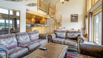
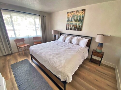
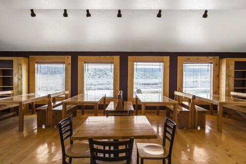
1. Historic Smith Hotel B&B
Historic Smith Hotel B&BGlendale
9.2 out of 10, Wonderful, (529 reviews)
"Beautiful setting and outdoor spaces for relaxing."

Diane
The price is 2.883.356 ₫
3.284.633 ₫ total
includes taxes & fees
4 Aug - 5 Aug


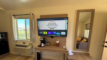
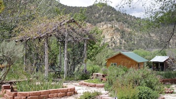
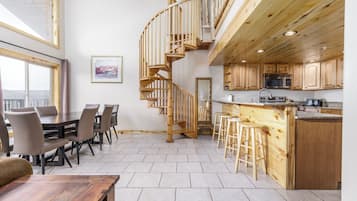
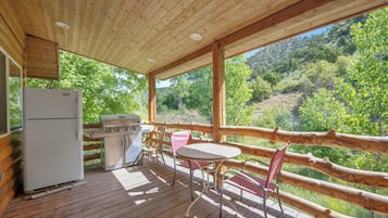
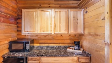
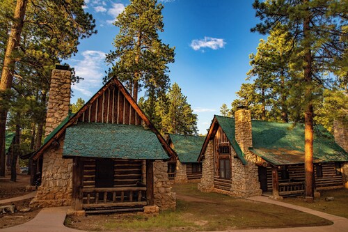
2. Mountain Ridge Cabins and Lodging
Mountain Ridge Cabins and LodgingHatch
9.2 out of 10, Wonderful, (1,001 reviews)
"Cabins were super cute, the beds were comfy, and was very clean!"
Amber
The price is 2.476.294 ₫
2.848.382 ₫ total
includes taxes & fees
6 Aug - 7 Aug

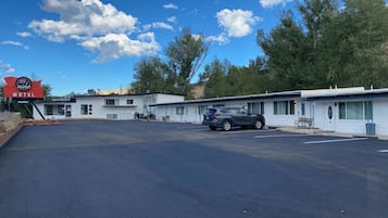

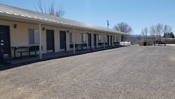
3. 89 & Nine Motel
89 & Nine MotelOrderville
8.6 out of 10, Excellent, (215 reviews)
"Perfect choice for our vacation !
Clean room
Close to all the attractions we visited
Great deal too!"
Henri
The price is 2.507.455 ₫
2.881.566 ₫ total
includes taxes & fees
4 Aug - 5 Aug

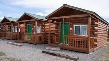

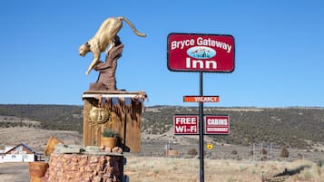
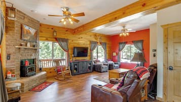
4. Bryce GatewayInn Cabins
Bryce GatewayInn CabinsPanguitch
7.8 out of 10, Good, (889 reviews)
"Close to Bryce National Park
Comfortable cabins"

Carlos
The price is 1.708.977 ₫
1.929.777 ₫ total
includes taxes & fees
4 Aug - 5 Aug


5. Hatch Station Motel and Restaurant
Hatch Station Motel and RestaurantHatch
8.6 out of 10, Excellent, (449 reviews)
"Staff was very friendly and room was also clean. Parking was easy to find a spot. If I visit this area I’d definitely stay again."
Furkan
The price is 1.288.504 ₫
1.482.306 ₫ total
includes taxes & fees
26 Aug - 27 Aug


6. Bryce Zion Inn
Bryce Zion InnHatch
7.8 out of 10, Good, (560 reviews)
"Nice place, nice view to the mountains"
Alejandro
The price is 1.551.464 ₫
1.769.195 ₫ total
includes taxes & fees
6 Aug - 7 Aug


7. Best Western East Zion Thunderbird Lodge
Best Western East Zion Thunderbird LodgeOrderville
9.2 out of 10, Wonderful, (1,003 reviews)
"Great stay"
Thomas
The price is 3.070.321 ₫
3.528.414 ₫ total
includes taxes & fees
10 Aug - 11 Aug


8. Bryce Canyon Pines
Bryce Canyon PinesBryce Canyon
8.0 out of 10, Very good, (1,017 reviews)
"Great place to stay!"
Sonya
The price is 1.632.982 ₫
1.843.964 ₫ total
includes taxes & fees
23 Aug - 24 Aug


9. The Riverside Ranch RV Park, Motel & Campground
The Riverside Ranch RV Park, Motel & CampgroundHatch
9.2 out of 10, Wonderful, (596 reviews)
"Great place to relax"
Roger
The price is 2.794.137 ₫
3.155.139 ₫ total
includes taxes & fees
31 Aug - 1 Sept


10. Rodeway Inn Bryce Canyon
Rodeway Inn Bryce CanyonPanguitch
8.0 out of 10, Very good, (1,001 reviews)
"This little place was awesome. A lot more cozy than I expected, with a lodge aesthetic inasmuch as there was decor. A good location, very comfy set of beds, and no hassle."
Jacob
The price is 1.373.703 ₫
1.551.201 ₫ total
includes taxes & fees
23 Aug - 24 Aug


11. Arrowhead Country Cabins
Arrowhead Country CabinsMount Carmel
9.6 out of 10, Exceptional, (91 reviews)
The price is 3.796.879 ₫
5.414.872 ₫ total
includes taxes & fees
7 Aug - 8 Aug


12. Duck Creek Village Inn
Duck Creek Village InnDuck Creek Village
9.4 out of 10, Exceptional, (175 reviews)
"It’s between Bryce national park and Zion national park but there it is in the middle of the Dixie national forest. There is a lot of stuff to donnewrby"
Daniel
The price is 5.096.165 ₫
5.984.679 ₫ total
includes taxes & fees
31 Aug - 1 Sept


13. The Lodge at Bryce Canyon
The Lodge at Bryce CanyonBryce Canyon
8.8 out of 10, Excellent, (132 reviews)
"The staffs are friendly and the location is excellent."
Hsuan-Ling
The price is 4.805.594 ₫
5.426.477 ₫ total
includes taxes & fees
17 Aug - 18 Aug


14. Aspen Cove resort
Aspen Cove resortPanguitch
7.0 out of 10, Good, (68 reviews)
"Great stay and the Loraine who works there was very helpful & friendly. "
Melina
The price is 4.897.630 ₫
5.530.404 ₫ total
includes taxes & fees
4 Aug - 5 Aug


15. The Lodge at Duck Creek
The Lodge at Duck CreekMeadow View Heights
9.4 out of 10, Exceptional, (98 reviews)
"Clean, quiet area, comfortable and cozy "
Andrea
The price is 5.656.270 ₫
10.395.861 ₫ total
includes taxes & fees
9 Aug - 10 Aug


16. Galaxy of Hatch between Bryce and Zion
Galaxy of Hatch between Bryce and ZionHatch
8.4 out of 10, Very good, (32 reviews)
"Yeah, it was totally awesome. Unique. Well done for an older establishment. The ambience made our motorcycle trip complete."
Andrew
The price is 2.106.310 ₫
2.401.351 ₫ total
includes taxes & fees
4 Aug - 5 Aug


17. Duck Creek Village Cabin Near National Forest!
Duck Creek Village Cabin Near National Forest!Meadow View Heights
The price is 4.601.800 ₫
11.553.148 ₫ total
includes taxes & fees
4 Aug - 5 Aug


19. Red Canyon Village
Red Canyon VillagePanguitch
4.8 out of 10, (3 reviews)
"Very clean cabin, comfy bed and very friendly staff."
Joanna
The price is 3.918.104 ₫
4.424.322 ₫ total
includes taxes & fees
4 Aug - 5 Aug


20. Bryce UpTop Lodge
Bryce UpTop LodgeBryce Canyon
7.0 out of 10, Good, (985 reviews)
"Loved the location to the National Park."
Kendra
The price is 2.129.976 ₫
2.405.169 ₫ total
includes taxes & fees
7 Aug - 8 Aug
Lowest nightly price found within the past 24 hours based on a 1 night stay for 2 adults. Prices and availability subject to change. Additional terms may apply.

Save an average of 15% on thousands of hotels when you're signed in
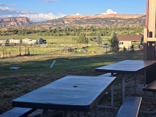
Stay near popular Alton attractions
Learn more about Alton
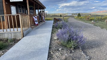
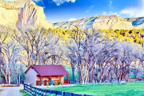
Nestled near the stunning Dixie National Forest, this tiny town offers hikers access to Red Hollow Canyon Trailhead and Mammoth Cave. Explore the natural wonders of Bryce Natural Bridge and Fairview Point, where southern Utah's remarkable landscapes unfold in every direction.

Photo by Eric & Kristy's Adventures
Open Photo by Eric & Kristy's Adventures
Top Alton Hotel Reviews
Best Western East Zion Thunderbird Lodge
10/10 Excellent

More cheap stays in Alton

Rodeway Inn Bryce Canyon
3090 UT 12 Panguitch UT
The price is 1.373.703 ₫ per night from 23 Aug to 24 Aug
1.373.703 ₫
1.551.201 ₫ total
23 Aug - 24 Aug
includes taxes & fees
8/10 Very good! (1,001 reviews)


Hotels in Alton with star rating

4 Star Hotels
3 properties

3 Star Hotels
66 properties

