

Nhà và căn hộ du lịch tại Alton
 Đổi ýĐặt phòng ở các khách sạn cho phép hủy miễn phí
 Chọn kỹTìm trong số gần một triệu nơi lưu trú trên toàn thế giới
Kiểm tra giá vào những ngày này
Hai tuần tới
Hai tháng tới
Ba tháng tới
Bốn tháng tới
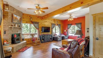
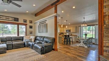
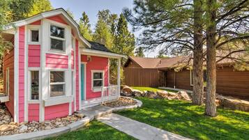
Lựa chọn hàng đầu của chúng tôi về nhà và căn hộ ở Alton


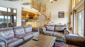
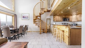
9.4 trên 10, Ngoại hạng, (98 nhận xét)
Giá hiện tại là 5.656.270 ₫
Tổng 10.395.861 ₫
bao gồm thuế & phí
09/08 - 10/08


4.8 trên 10, (3 nhận xét)
"So bad we checked out early! Our "Premier" cabin was less than premier. Poor linens, it was maybe 12' from the highway, the television did not work nor any internet connection. We talked to the person who checked us in, and he moved us to a much smaller cabin where everything was supposed to work. We tried to make it work but just couldn't. The bed was smaller and uncomfortable and when we tried to take a shower in a very inadequate space the water smelled severely of sulfur. It made us sick....

Kimberly
Giá hiện tại là 3.918.104 ₫
Tổng 4.424.322 ₫
bao gồm thuế & phí
04/08 - 05/08


3. Between Bryce Canyon & Zion: Hiker's Paradise!
Between Bryce Canyon & Zion: Hiker's Paradise!Hatch
Giá hiện tại là 5.416.976 ₫
Tổng 9.930.158 ₫
bao gồm thuế & phí
04/08 - 05/08


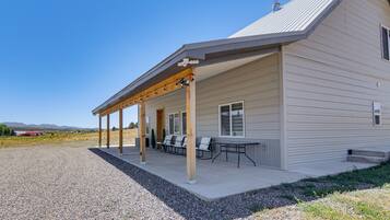
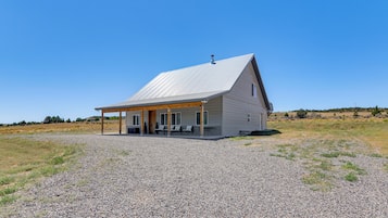
4. Duck Creek Village Cabin Near National Forest!
Duck Creek Village Cabin Near National Forest!Meadow View Heights
Giá hiện tại là 4.601.800 ₫
Tổng 11.553.148 ₫
bao gồm thuế & phí
04/08 - 05/08


5. Luxe Home ~ 2 Mi to Bryce Canyon National Park!
Luxe Home ~ 2 Mi to Bryce Canyon National Park!Bryce Canyon
Giá hiện tại là 8.625.088 ₫
Tổng 15.484.137 ₫
bao gồm thuế & phí
17/08 - 18/08
Giá thấp nhất mỗi đêm dựa trên kết quả tìm kiếm trong vòng 24 giờ qua cho 1 đêm lưu trú cho 2 người lớn. Giá và tình trạng phòng có thể thay đổi. Có thể áp dụng điều khoản bổ sung.
Tìm nhà và căn hộ phù hợp với phong cách của bạn
Căn hộ
Nhà nghỉ tư nhân

Đăng nhập để tiết kiệm trung bình 15% tại hàng ngàn khách sạn
Nhận xét hàng đầu về khách sạn ở Alton
Thông tin cần biết về Alton
Tìm nhà và căn hộ du lịch tại Alton trên Expedia.com.vn. Dễ dàng tìm nhà và căn hộ, biệt thự, căn hộ du lịch tại Alton bằng một trong những cách sau:
- Xem danh sách nhà và căn hộ du lịch tại Alton của chúng tôi
- Sử dụng bản đồ để tìm nhà và căn hộ du lịch tại những khu vực thuộc Alton tùy theo nhu cầu
- Nhập ngày đi dự kiến để xem ưu đãi hàng đầu tại những ngôi nhà và căn hộ du lịch ở Alton
Không cần tìm đâu xa, hãy xem danh sách những nơi lưu trú du lịch đa dạng của chúng tôi tại Alton!

